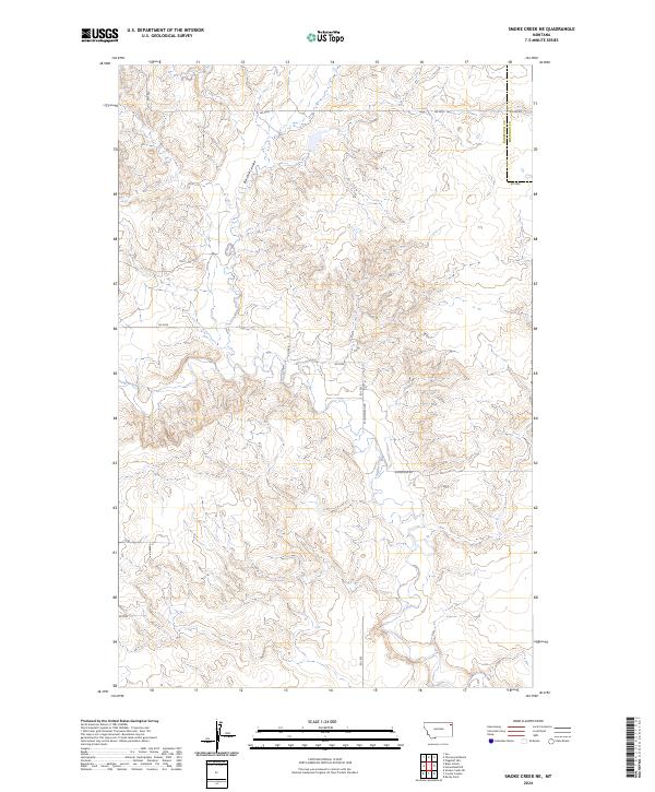
2024 Map of Smoke Creek NE
USGS Topo · Published 2024About this map
Smoke Creek and Burshia Coulee define the drainage patterns across this high-plains landscape on the border of Roosevelt and Sheridan counties. The terrain is marked by the intricate erosional features of the coulees, illustrating the complex topography characteristic of the Missouri River plateau region. A grid of rural roads, including W Homestead Rd and W Lake Rd, provides access to the expansive sections of the Public Land Survey System, which are clearly delineated as townships T30N through T32N. While the map is dominated by these natural drainages and the geometric division of the land, the lack of concentrated settlements highlights the open, agricultural character of this portion of northeastern Montana. Local transit is facilitated by a network of numbered routes such as Rd 1035 and Rd 2035, which connect the isolated homesteads and ranch lands that populate this frontier environment.
Find a feature on this map
19 named features on this map. Tap any name to fly to it.
Don’t see what you’re looking for? This feature index may not catch every label — zoom into the map to look around manually.
Map Details
Editions of this 2024 Smoke Creek NE Map
This is the sole edition of this map. No revisions or reprints were ever made.
Other maps of this area

1909 · Smoke Creek
USGS Topo · 1:62,500

1912 · Smoke Creek
USGS Topo · 1:62,500

1914 · Homestead
USGS Topo · 1:62,500

1947 · Rocky Point
USGS Topo · 1:24,000

1948 · Rocky Point
USGS Topo · 1:24,000

1950 · Coyote Coulee
USGS Topo · 1:24,000

1954 · Wolf Point
USGS Topo · 1:250,000

1958 · Wolf Point
USGS Topo · 1:250,000

1982 · Culbertson
USGS Topo · 1:100,000
1983 · Homestead NW
USGS Topo · 1:24,000