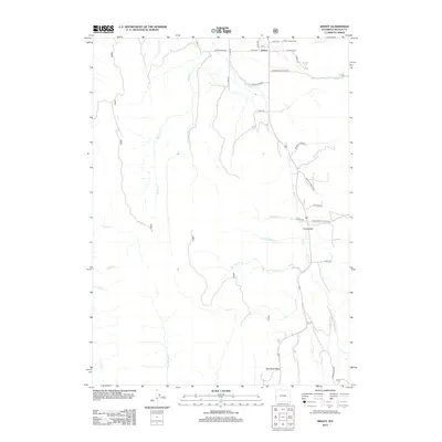
2012 Map of Smoot
USGS Topo · Published 2012About this map
Smoot serves as the primary settlement in this corner of Lincoln County, situated where the Salt River begins its course northward through the valley. The landscape is defined by a dense network of drainage systems feeding the river, including Cottonwood Cr, Gomm Cr, and Christopherson Cr. Near the northern edge, the Smoot Cem and a KOA Campground sit along the primary transit corridor, while to the south, the terrain climbs toward the Salt River Pass. The map reveals a transition from the valley floor settlements like Forest Dell to the more isolated creek systems of N Fork Fish Cr and Little White Cr. This topographic study provides a clear view of the rural road network, featuring routes such as Bitter Creek RD and Smiths Fork RD that follow the natural contours of the western Wyoming highlands.
Find a feature on this map
38 named features on this map. Tap any name to fly to it.
Don’t see what you’re looking for? This feature index may not catch every label — zoom into the map to look around manually.
Map Details
Editions of this 2012 Smoot Map
This is the sole edition of this map. No revisions or reprints were ever made.
Other maps of this area

1909 · Montpelier
USGS Topo · 1:125,000

1911 · Montpelier
USGS Topo · 1:125,000

1915 · Crow Creek
USGS Topo · 1:62,500

1921 · Afton
USGS Topo · 1:125,000

1936 · Cokeville
USGS Topo · 1:96,000

1942 · Cokeville
USGS Topo · 1:125,000

1955 · Preston
USGS Topo · 1:250,000

1958 · Preston
USGS Topo · 1:250,000

1962 · Preston
USGS Topo · 1:250,000

1967 · Porcupine Creek
USGS Topo · 1:24,000