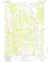
1980 Map of Smoot
USGS Topo · Published 1980About this map
The Emigrant Trail (Lander Cutoff) traces a historic westward path through the Star Valley, skirting the eastern edge of the Gannett Hills as it follows the Salt River. This 1980 survey captures the settlement of Smoot and the surrounding agricultural landscape, where the Johnson Ditch redirects water across the valley floor. To the south, the terrain becomes increasingly complex as the Salt River Pass provides a transition toward the Smiths Fork drainage. The map documents an extensive network of movement, from the historical Emigrant Road to modern forest infrastructure like the Pack Trail systems within the Bridger National Forest. Numerous named waterways, including Willow Creek and Christopherson Creek, dissect the western highlands, illustrating the vital riparian corridors that defined local ranching and transit during this era.
Find a feature on this map
36 named features on this map. Tap any name to fly to it.
Don’t see what you’re looking for? This feature index may not catch every label — zoom into the map to look around manually.
Map Details
Editions of this 1980 Smoot Map
This is the sole edition of this map. No revisions or reprints were ever made.
Other maps of this area

1909 · Montpelier
USGS Topo · 1:125,000

1911 · Montpelier
USGS Topo · 1:125,000

1915 · Crow Creek
USGS Topo · 1:62,500

1921 · Afton
USGS Topo · 1:125,000

1936 · Cokeville
USGS Topo · 1:96,000

1942 · Cokeville
USGS Topo · 1:125,000

1955 · Preston
USGS Topo · 1:250,000

1958 · Preston
USGS Topo · 1:250,000

1962 · Preston
USGS Topo · 1:250,000

1967 · Porcupine Creek
USGS Topo · 1:24,000