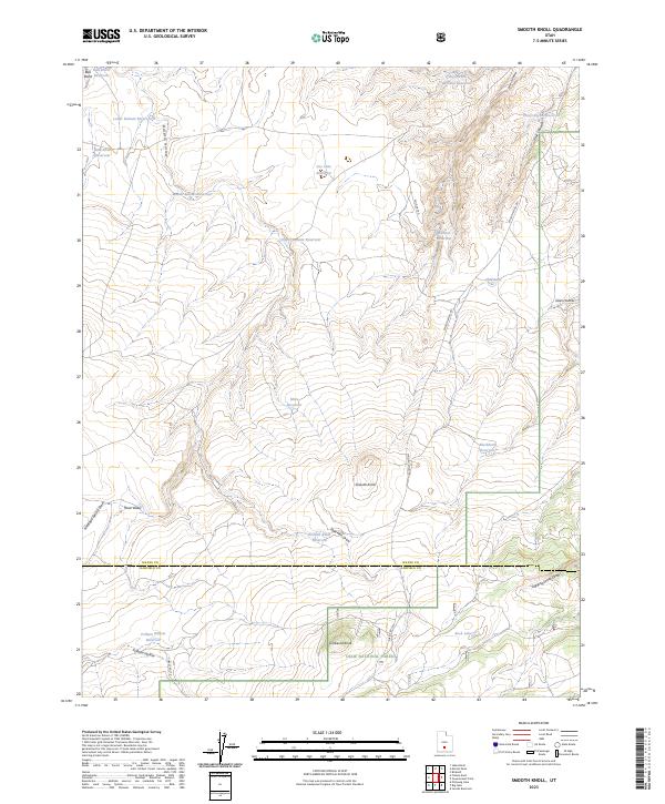
2023 Map of Smooth Knoll
USGS Topo · Published 2023About this map
High-altitude water management defines the landscape of the Dixie National Forest along the border of Wayne and Garfield counties. This 2023 survey reveals an intricate network of catchments and storage, including the Bull Roost, Upper Balsam, and Wildcat reservoirs. These features, often named for local terrain like Balsam Hollow or Wildcat Hollow, illustrate the critical importance of water resources in the arid Utah uplands. The terrain is marked by distinctive elevations such as Smooth Knoll and Timbered Knoll, while drainage patterns are traced through Antelope Spring Draw and Sage Hen Draw. Historically significant forest access is maintained via Wild Cat Rd and Smooth Knoll Rd, providing a detailed view of the infrastructure supporting both resource management and recreation in this part of the Colorado Plateau.
Find a feature on this map
33 named features on this map. Tap any name to fly to it.
Don’t see what you’re looking for? This feature index may not catch every label — zoom into the map to look around manually.
Map Details
Editions of this 2023 Smooth Knoll Map
This is the sole edition of this map. No revisions or reprints were ever made.
Other maps of this area

1885 · Fish Lake
USGS Topo · 1:250,000

1896 · Fish Lake
USGS Topo · 1:250,000

1952 · Loa 1 SE
USGS Topo · 1:24,000

1953 · Loa 4 NE
USGS Topo · 1:24,000

1956 · Salina
USGS Topo · 1:250,000

1960 · Salina
USGS Topo · 1:250,000

1962 · Salina
USGS Topo · 1:250,000
1969 · Smooth Knoll
USGS Topo · 1:24,000
1969 · Flossie Knoll
USGS Topo · 1:24,000
1969 · Jakes Knoll
USGS Topo · 1:24,000