
1963 Map of Smyrna
USGS Topo · Published 1964About this map
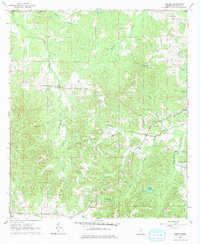
Smyrna and Bowerton anchor this rural landscape in Copiah County during the early 1960s, a region defined by its dense network of small family churches and winding creek valleys. The topography is deeply carved by water, with Halls Creek, Jackson Creek, and Bishop Valley Creek creating a complex drainage system through the wooded hills. For genealogists, the map is particularly valuable for its precise location of community landmarks like Mt Olive Ch and its accompanying Mt Olive Cem, as well as New Zion Ch and Pineleaf Cem. The eastern portion of the quadrangle shows the expansive Kaywood Plantation and a nearby Landing Strip, indicating larger landholdings and modernization. Industrial activity is represented by scattered Gravel Pits, while the prominent Base Line survey marker cuts across the northern section, illustrating the foundational grid of Mississippi's land division.
Find a feature on this map
27 named features on this map. Tap any name to fly to it.
Don’t see what you’re looking for? This feature index may not catch every label — zoom into the map to look around manually.
Map Details
Editions of this 1963 Smyrna Map
2 editions found
Other maps of this area

1953 · Natchez
USGS Topo · 1:250,000

1956 · Natchez
USGS Topo · 1:250,000

1959 · Natchez
USGS Topo · 1:250,000

1963 · Dentville NW
USGS Topo · 1:24,000

1963 · Dentville
USGS Topo · 1:24,000
1963 · Gallman
USGS Topo · 1:24,000

1963 · Hazlehurst
USGS Topo · 1:24,000

1963 · Barlow
USGS Topo · 1:24,000

1972 · Midway
USGS Topo · 1:24,000

1972 · Caseyville
USGS Topo · 1:24,000