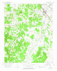
1957 Map of Smyrna
USGS Topo · Published 1967About this map
Smyrna sits at the junction of the Nashville Chattanooga and St Louis Railway and the Old Nashville Highway, serving as a central hub for this portion of Middle Tennessee. The landscape is defined by the sweeping course of Stewart Creek and a series of prominent knobs, including Sanford Knob and Signal Knob. The presence of the US Military Reservation (Stewart Air Force Base) in the northeast corner signifies the era's strategic importance, while the Sam Davis Home marks a significant local historical landmark. Rural life is evidenced by numerous educational and religious centers such as Rosenwald Sch, Seminary Sch, and Lillard Chapel. The map reveals a high density of family burial grounds, including the Dewitt-Smith-Jobe Cem and Vaugh-McClaren Cem, providing essential data for genealogical research into the families of Rutherford, Davidson, and Williamson counties.
Find a feature on this map
74 named features on this map. Tap any name to fly to it.
Don’t see what you’re looking for? This feature index may not catch every label — zoom into the map to look around manually.
Map Details
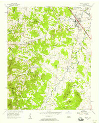
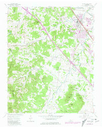
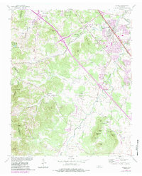
Editions of this 1957 Smyrna Map
4 editions found
Other maps of this area

1903 · Nashville
USGS Topo · 1:125,000

1916 · Murfreesboro
USGS Topo · 1:62,500

1932 · Hermitage
USGS Topo · 1:62,500

1942 · Lebanon
USGS Topo · 1:100,000

1950 · Walterhill
USGS Topo · 1:24,000

1950 · Murfreesboro
USGS Topo · 1:24,000

1952 · La Vergne
USGS Topo · 1:24,000

1952 · Antioch
USGS Topo · 1:24,000

1956 · Gladeville
USGS Topo · 1:24,000

1956 · Columbia
USGS Topo · 1:250,000