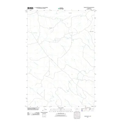
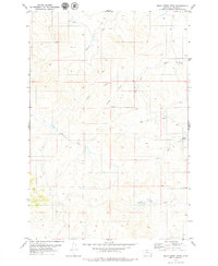
2011 Map of Snake Butte
USGS Topo · Published 2011About this map
Snake Butte and the distinctive formations of Twin Buttes rise above the drainage systems of the Powder River basin in this early twenty-first-century survey. The landscape is defined by its intermittent watercourses, including Spring Creek, Meadow Creek, and Little Corral Creek, which carve out the high plains topography. A central human element in this section of Powder River County is Powderville Rd, which cuts diagonally across the terrain, providing a critical transit link through an area dominated by buttes and creek beds. Near the eastern edge, Chimney Butte stands as a notable landmark overlooking the convergence of local seasonal streams like W L Creek and Butte Creek. The map documents a sparsely settled ranching or grazing environment where the geography of the land remains the primary feature, illustrating the persistent character of Montana's southeastern plains.
Find a feature on this map
11 named features on this map. Tap any name to fly to it.
Don’t see what you’re looking for? This feature index may not catch every label — zoom into the map to look around manually.
Map Details
Editions of this 2011 Snake Butte Map
This is the sole edition of this map. No revisions or reprints were ever made.
Other maps of this area

1954 · Ekalaka
USGS Topo · 1:250,000

1956 · Ekalaka
USGS Topo · 1:250,000

1958 · Ekalaka
USGS Topo · 1:250,000

1965 · Ekalaka
USGS Topo · 1:250,000
1973 · Maxwell Butte
USGS Topo · 1:24,000

1973 · Cross S School
USGS Topo · 1:24,000
1973 · Rattlesnake Hill
USGS Topo · 1:24,000
1979 · Mills Creek East
USGS Topo · 1:24,000

1979 · Powderville
USGS Topo · 1:24,000
1979 · Mills Creek West
USGS Topo · 1:24,000