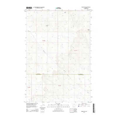
2014 Map of Snake Butte
USGS Topo · Published 2014About this map
Snake Butte and Twin Buttes anchor the skyline of this high plains landscape along the border of Custer and Powder River counties. The terrain is defined by a network of drainage systems, including Spring Cr and Meadow Cr, which carve through the land beneath the prominent Chimney Butte. These topographical landmarks served as critical navigational points for early inhabitants and ranchers moving through this corner of Montana.
Find a feature on this map
18 named features on this map. Tap any name to fly to it.
Don’t see what you’re looking for? This feature index may not catch every label — zoom into the map to look around manually.
Map Details
Editions of this 2014 Snake Butte Map
This is the sole edition of this map. No revisions or reprints were ever made.
Other maps of this area

1954 · Ekalaka
USGS Topo · 1:250,000

1956 · Ekalaka
USGS Topo · 1:250,000

1958 · Ekalaka
USGS Topo · 1:250,000

1965 · Ekalaka
USGS Topo · 1:250,000
1973 · Maxwell Butte
USGS Topo · 1:24,000

1973 · Cross S School
USGS Topo · 1:24,000
1973 · Rattlesnake Hill
USGS Topo · 1:24,000
1979 · Mills Creek East
USGS Topo · 1:24,000

1979 · Powderville
USGS Topo · 1:24,000
1979 · Mills Creek West
USGS Topo · 1:24,000