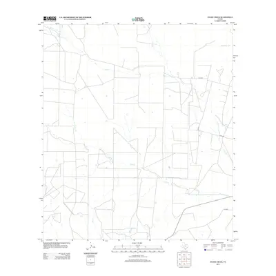
2013 Map of Snake Creek
USGS Topo · Published 2013About this map
Cibolo Cr and Snake Cr define the hydrological character of this South Texas landscape, carving shallow paths through a region structured by large-scale ranching or agricultural tracts. The map reveals a highly organized grid of rural infrastructure, where long-standing family and regional routes like Hurt Rd and Co Rd 4850 provide access to the interior. The drainage network is complex for a semi-arid region, with Medio Cr, Espio Cr, and Elm Cr all feeding into the larger watershed. This survey captures the intersection of natural watercourses and the straight-line property boundaries typical of Frio County, showing how the local economy relies on these intermittent waterways and the road network connecting remote farmsteads.
Find a feature on this map
10 named features on this map. Tap any name to fly to it.
Don’t see what you’re looking for? This feature index may not catch every label — zoom into the map to look around manually.
Map Details
Editions of this 2013 Snake Creek Map
This is the sole edition of this map. No revisions or reprints were ever made.
Other maps of this area

1939 · Big Wells
USGS Topo · 1:62,500

1942 · Divot
USGS Topo · 1:62,500

1953 · Crystal City
USGS Topo · 1:250,000

1955 · Crystal City
USGS Topo · 1:250,000

1956 · Woodward
USGS Topo · 1:62,500

1956 · Divot
USGS Topo · 1:62,500

1957 · Batesville
USGS Topo · 1:62,500

1961 · Crystal City
USGS Topo · 1:250,000

1968 · Crystal City
USGS Topo · 1:250,000
1972 · Big Wells
USGS Topo · 1:24,000