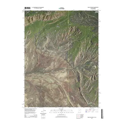
2014 Map of Snake John Reef
USGS Topo · Published 2014About this map
Dinosaur National Monument defines the northeastern boundary of this survey, where the high elevation of Blue Mtn Plateau and Stuntz Ridge overlooks a complex network of canyons and draws. The landscape is characterized by prominent geological ridges, including Cliff Ridge and the namesake Snake John Reef, which runs southeast across the center of the sheet. Modern infrastructure is limited to Us-40, which skirts the southern edge of these massive rock formations near the town of Dinosaur. Numerous seasonal waterways, such as Snake John Wash and Sand Spring Wash, drain the terrain, highlighting the arid character of this borderland. The map also captures the Utah Colorado state line and the junction of Uintah and Moffat counties, marking an area where transportation routes follow the natural path through Miners Draw and Bull Canyon.
Find a feature on this map
33 named features on this map. Tap any name to fly to it.
Don’t see what you’re looking for? This feature index may not catch every label — zoom into the map to look around manually.
Map Details
Editions of this 2014 Snake John Reef Map
This is the sole edition of this map. No revisions or reprints were ever made.
Other maps of this area

1885 · Ashley
USGS Topo · 1:250,000

1907 · Rangely
USGS Topo · 1:125,000

1907 · Jensen
USGS Topo · 1:125,000

1910 · Jensen
USGS Topo · 1:125,000

1910 · Rangely
USGS Topo · 1:125,000

1954 · Hells Canyon
USGS Topo · 1:24,000

1954 · Vernal
USGS Topo · 1:250,000

1955 · Stuntz Reservoir
USGS Topo · 1:24,000

1955 · Split Mountain
USGS Topo · 1:24,000

1958 · Vernal
USGS Topo · 1:250,000