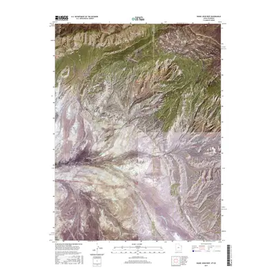
2017 Map of Snake John Reef
USGS Topo · Published 2017About this map
Snake John Reef and its prominent geological formations dominate this landscape at the intersection of the Utah and Colorado border. The area is defined by sharp topographic shifts, where the high elevations of Cliff Ridge and Stuntz Ridge give way to a network of drainage systems including Miners Draw and Buckwater Draw. In the southern portion of the quadrangle, the settlement of Dinosaur sits near the junction of major washes like Sand Spring Wash, illustrating how human activity in this arid region centers around the few navigable paths through the ridges. The map meticulously traces a series of unpaved routes such as Miners Draw Rd, K Ranch Rd, and Trail Creek Rd, which provide access to the remote canyons and draws of Daniels Canyon and Bull Canyon.
Find a feature on this map
30 named features on this map. Tap any name to fly to it.
Don’t see what you’re looking for? This feature index may not catch every label — zoom into the map to look around manually.
Map Details
Editions of this 2017 Snake John Reef Map
This is the sole edition of this map. No revisions or reprints were ever made.
Other maps of this area

1885 · Ashley
USGS Topo · 1:250,000

1907 · Rangely
USGS Topo · 1:125,000

1907 · Jensen
USGS Topo · 1:125,000

1910 · Jensen
USGS Topo · 1:125,000

1910 · Rangely
USGS Topo · 1:125,000

1954 · Hells Canyon
USGS Topo · 1:24,000

1954 · Vernal
USGS Topo · 1:250,000

1955 · Stuntz Reservoir
USGS Topo · 1:24,000

1955 · Split Mountain
USGS Topo · 1:24,000

1958 · Vernal
USGS Topo · 1:250,000