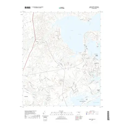
2019 Map of Sneads Ferry
USGS Topo · Published 2019About this map
Stones Bay and the expansive New River dominate this coastal landscape, where the tides of the Atlantic Ocean meet the intricate network of the Intracoastal Waterway. The 2019 topography highlights the fishing and maritime heritage of Onslow County, anchored by the community of Sneads Ferry and the nearby Fulcher Landing. To the south, the map details the barrier island geography of Topsail Island and the residential development at North Topsail Beach. The interior transition from the wetlands of S Pocosin to the established settlements at Dixon and Holly Ridge illustrates the balance between the region's natural marshlands and its growing infrastructure. Numerous family-named points, such as Pollocks Point and Hines Point, along with small tributaries like Wheeler Creek and Everett Cr, provide fine-grained detail for local historians and genealogists studying the evolution of this waterfront corridor.
Find a feature on this map
140 named features on this map. Tap any name to fly to it.
Don’t see what you’re looking for? This feature index may not catch every label — zoom into the map to look around manually.
Map Details
Editions of this 2019 Sneads Ferry Map
This is the sole edition of this map. No revisions or reprints were ever made.
Other maps of this area

1942 · Spicer Bay
USGS Topo · 1:62,500

1942 · Topsail
USGS Topo · 1:62,500

1948 · Maple Hill
USGS Topo · 1:62,500

1948 · Topsail
USGS Topo · 1:62,500

1948 · New River
USGS Topo · 1:62,500

1952 · Camp Lejeune
USGS Topo · 1:24,000

1952 · Jacksonville South
USGS Topo · 1:24,000

1952 · Spicer Bay
USGS Topo · 1:24,000

1952 · New River Inlet
USGS Topo · 1:24,000

1952 · Sneads Ferry
USGS Topo · 1:24,000