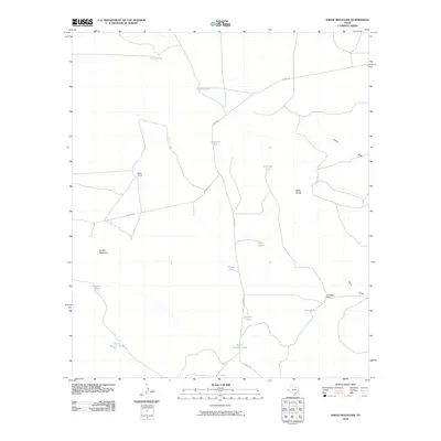
2010 Map of Sneed Mountain
USGS Topo · Published 2010About this map
Sneed Mountain rises above a landscape defined by an essential ranching infrastructure in this part of Hudspeth County. The placement of named water sources like Owen Tank, Dagger Tank, and Beeman Tank reveals the vital points of a desert livestock economy, where localized rainfall must be captured and managed. These features, along with South Beeman Tank and Potts Tank, serve as the primary landmarks across the arid terrain.
Find a feature on this map
19 named features on this map. Tap any name to fly to it.
Don’t see what you’re looking for? This feature index may not catch every label — zoom into the map to look around manually.
Map Details
Editions of this 2010 Sneed Mountain Map
This is the sole edition of this map. No revisions or reprints were ever made.
Other maps of this area

1895 · Sierra Blanca
USGS Topo · 1:125,000

1906 · Van Horn
USGS Topo · 1:125,000

1954 · Van Horn
USGS Topo · 1:250,000

1958 · Van Horn
USGS Topo · 1:250,000
1964 · Sheep Peak
USGS Topo · 1:24,000

1964 · Dome Peak
USGS Topo · 1:24,000
1964 · Bean Hills
USGS Topo · 1:24,000

1973 · Norton Mesa
USGS Topo · 1:24,000

1973 · Sneed Mountain NE
USGS Topo · 1:24,000

1973 · Apache Peak
USGS Topo · 1:24,000