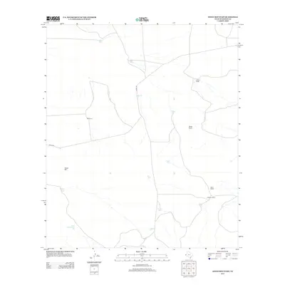
2012 Map of Sneed Mountain
USGS Topo · Published 2012About this map
Water management dominates the arid landscape of Hudspeth County, visible through a dense network of man-made tanks used for livestock and ranching. The presence of Preston Tank, Owen Tank, and Three Section Tank illustrates the vital infrastructure required to sustain agriculture in this high-desert environment. These features are clustered around established family holdings such as Reed Ranch and the G McAdoo Ranch. Terrain features like the Black Knobs and the namesake Sneed Mtn provide essential landmarks for navigation across the basin. Local transit depends on a sparse road network including Macado Rd and Garren Rd, which connect the isolated ranching operations to the broader region through the natural corridors of Collier Draw and Cave Draw.
Find a feature on this map
19 named features on this map. Tap any name to fly to it.
Don’t see what you’re looking for? This feature index may not catch every label — zoom into the map to look around manually.
Map Details
Editions of this 2012 Sneed Mountain Map
This is the sole edition of this map. No revisions or reprints were ever made.
Other maps of this area

1895 · Sierra Blanca
USGS Topo · 1:125,000

1906 · Van Horn
USGS Topo · 1:125,000

1954 · Van Horn
USGS Topo · 1:250,000

1958 · Van Horn
USGS Topo · 1:250,000
1964 · Sheep Peak
USGS Topo · 1:24,000

1964 · Dome Peak
USGS Topo · 1:24,000
1964 · Bean Hills
USGS Topo · 1:24,000

1973 · Norton Mesa
USGS Topo · 1:24,000

1973 · Sneed Mountain NE
USGS Topo · 1:24,000

1973 · Apache Peak
USGS Topo · 1:24,000