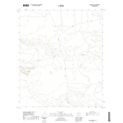
2019 Map of Sneed Mountain
USGS Topo · Published 2019About this map
Sneed Mtn stands as a prominent landmark in this corner of Hudspeth County, where the high desert terrain is defined by complex contouring and seasonal water management. The landscape relies on an extensive network of water catchments, including Owen Tank, Dagger Tank, and South Beeman Tank, which are essential for supporting life and ranching in this arid environment. These features are connected by rudimentary transportation routes like Garren Rd and Macado Rd, which navigate the elevation changes between the plains and the uplifted regions of the Black Knobs. Notable drainage patterns are visible through Collier Draw and Cave Draw, illustrating the natural path of runoff through the desert. This 2019 survey documents a sparsely settled region where human presence is primarily marked by these critical water infrastructure points and remote roadway networks.
Find a feature on this map
17 named features on this map. Tap any name to fly to it.
Don’t see what you’re looking for? This feature index may not catch every label — zoom into the map to look around manually.
Map Details
Editions of this 2019 Sneed Mountain Map
This is the sole edition of this map. No revisions or reprints were ever made.
Other maps of this area

1895 · Sierra Blanca
USGS Topo · 1:125,000

1906 · Van Horn
USGS Topo · 1:125,000

1954 · Van Horn
USGS Topo · 1:250,000

1958 · Van Horn
USGS Topo · 1:250,000
1964 · Sheep Peak
USGS Topo · 1:24,000

1964 · Dome Peak
USGS Topo · 1:24,000
1964 · Bean Hills
USGS Topo · 1:24,000

1973 · Norton Mesa
USGS Topo · 1:24,000

1973 · Sneed Mountain NE
USGS Topo · 1:24,000

1973 · Apache Peak
USGS Topo · 1:24,000