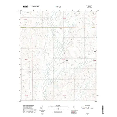
2018 Map of Snell
USGS Topo · Published 2018About this map
The Lauderdale Co Clarke Co boundary divides this landscape, where the headwaters of the Pascagoula River basin begin to take shape. The small settlements of Snell, Energy, and Middleton are linked by a network of county roads, including Co Rd 514 and Co Rd 450. The area is defined by its dense drainage system, with numerous watercourses such as Buckatunna Cr, Irby Mill Cr, and Hurricane Cr carving through the terrain.
Find a feature on this map
45 named features on this map. Tap any name to fly to it.
Don’t see what you’re looking for? This feature index may not catch every label — zoom into the map to look around manually.
Map Details
Editions of this 2018 Snell Map
This is the sole edition of this map. No revisions or reprints were ever made.
Other maps of this area

1921 · Meridian
USGS Topo · 1:48,000

1923 · Meridian
USGS Topo · 1:62,500

1953 · Meridian
USGS Topo · 1:250,000

1957 · Meridian
USGS Topo · 1:250,000

1957 · Quitman
USGS Topo · 1:62,500

1965 · Meridian
USGS Topo · 1:250,000

1971 · Vimville
USGS Topo · 1:24,000

1971 · Meridian South
USGS Topo · 1:24,000

1974 · Yantley
USGS Topo · 1:24,000
1974 · Hinton
USGS Topo · 1:24,000