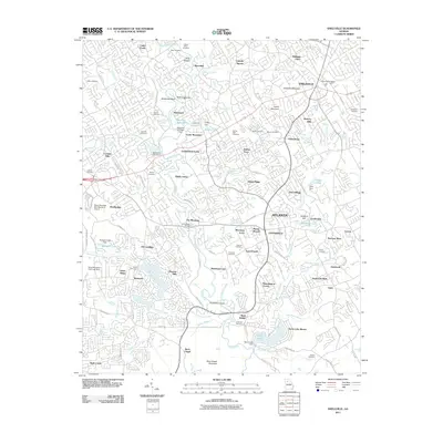
2011 Map of Snellville
USGS Topo · Published 2011About this map
Snellville and the expanding suburbs northeast of Atlanta are defined by a high density of residential developments and family cemeteries. The Yellow River meanders through the center of the landscape, passing beneath McDaniels Bridge and over Britt Shoals. This suburban character is punctuated by significant terrain features like Snellville Mountain and Rock Chapel Mountain, which overlook a network of modern neighborhoods such as Rivermist, Hickory Hills, and Timber Trace.
Find a feature on this map
95 named features on this map. Tap any name to fly to it.
Don’t see what you’re looking for? This feature index may not catch every label — zoom into the map to look around manually.
Map Details
Editions of this 2011 Snellville Map
This is the sole edition of this map. No revisions or reprints were ever made.
Other maps of this area

1888 · Atlanta
USGS Topo · 1:125,000

1890 · Atlanta
USGS Topo · 1:125,000

1892 · Atlanta
USGS Topo · 1:125,000

1895 · Atlanta
USGS Topo · 1:125,000

1896 · Monroe
USGS Topo · 1:125,000

1953 · Atlanta
USGS Topo · 1:250,000

1953 · Athens
USGS Topo · 1:250,000

1956 · Stone Mountain
USGS Topo · 1:24,000

1956 · Snellville
USGS Topo · 1:24,000
1956 · Norcross
USGS Topo · 1:24,000