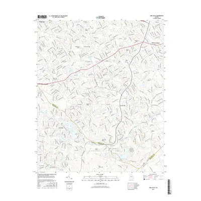
2017 Map of Snellville
USGS Topo · Published 2017About this map
McDaniels Bluff and Lanier Mtn rise above the suburban landscape of eastern Snellville, where a dense network of residential streets meets the winding course of the Yellow River. This survey captures the transition of the Georgia Piedmont, showing established communities like Centerville and Bermuda alongside numerous family burial grounds, including the Hannah Cem and Sodom Cem. Significant water features like Stone Mountain Lake and Norris Lake appear near the Gwinnett Co and DeKalb Co border, marking the area's recreational geography. The presence of the LT World Airport and major corridors like Centerville Hwy illustrate the 21st-century infrastructure supporting this growing region northeast of the Stone Mountain monolith.
Find a feature on this map
57 named features on this map. Tap any name to fly to it.
Don’t see what you’re looking for? This feature index may not catch every label — zoom into the map to look around manually.
Map Details
Editions of this 2017 Snellville Map
This is the sole edition of this map. No revisions or reprints were ever made.
Other maps of this area

1888 · Atlanta
USGS Topo · 1:125,000

1890 · Atlanta
USGS Topo · 1:125,000

1892 · Atlanta
USGS Topo · 1:125,000

1895 · Atlanta
USGS Topo · 1:125,000

1896 · Monroe
USGS Topo · 1:125,000

1953 · Atlanta
USGS Topo · 1:250,000

1953 · Athens
USGS Topo · 1:250,000

1956 · Stone Mountain
USGS Topo · 1:24,000

1956 · Snellville
USGS Topo · 1:24,000
1956 · Norcross
USGS Topo · 1:24,000