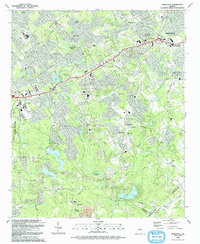
1992 Map of Snellville
USGS Topo · Published 1993About this map
Snellville serves as the primary urban center in this early 1990s study of Gwinnett County, illustrating a landscape in transition as residential growth follows established corridors like Killian Hill Road. The terrain is defined by prominent elevations such as Snellville Mountain and the eastern fringes of Stone Mountain Memorial State Park, with the Yellow River cutting a winding path through the center, notably at the Yellow Horseshoe Bend.
Find a feature on this map
119 named features on this map. Tap any name to fly to it.
Don’t see what you’re looking for? This feature index may not catch every label — zoom into the map to look around manually.
Map Details
Editions of this 1992 Snellville Map
This is the sole edition of this map. No revisions or reprints were ever made.
Other maps of this area

1888 · Atlanta
USGS Topo · 1:125,000

1890 · Atlanta
USGS Topo · 1:125,000

1892 · Atlanta
USGS Topo · 1:125,000

1895 · Atlanta
USGS Topo · 1:125,000

1896 · Monroe
USGS Topo · 1:125,000

1953 · Atlanta
USGS Topo · 1:250,000

1953 · Athens
USGS Topo · 1:250,000

1956 · Stone Mountain
USGS Topo · 1:24,000

1956 · Snellville
USGS Topo · 1:24,000
1956 · Norcross
USGS Topo · 1:24,000