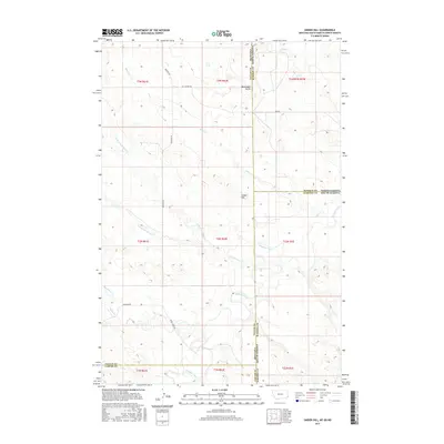
2017 Map of Snider Hill
USGS Topo · Published 2017About this map
Snider Hill and Monument Butte dominate this landscape where the high plains of Montana, North Dakota, and South Dakota converge. The geography is defined by a dense network of seasonal drainages, including the various branches of Coal Bank Cr and the winding course of Boxelder Creek. This tri-state boundary area serves as a significant corner for Fallon and Carter Counties in Montana, Bowman County in North Dakota, and Harding County in South Dakota. Transport through this remote rangeland follows established routes like Webster Rd and the Horse Creek Trl, reflecting a long-standing pattern of cattle ranching and land management. The presence of numerous named watercourses such as Sheep Cr and Soda Cr underscores the importance of watershed management in this semi-arid environment during the early 21st century.
Find a feature on this map
28 named features on this map. Tap any name to fly to it.
Don’t see what you’re looking for? This feature index may not catch every label — zoom into the map to look around manually.
Map Details
Editions of this 2017 Snider Hill Map
This is the sole edition of this map. No revisions or reprints were ever made.
Other maps of this area

1935 · Buffalo
USGS Topo · 1:125,000

1953 · Miles City
USGS Topo · 1:250,000

1953 · Dickinson
USGS Topo · 1:250,000

1954 · Lemmon
USGS Topo · 1:250,000

1954 · Ekalaka
USGS Topo · 1:250,000

1956 · Ekalaka
USGS Topo · 1:250,000

1957 · Dickinson
USGS Topo · 1:250,000

1957 · Lemmon
USGS Topo · 1:250,000

1957 · Miles City
USGS Topo · 1:250,000

1958 · Miles City
USGS Topo · 1:250,000