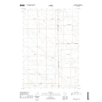
2020 Map of Snider Hill
USGS Topo · Published 2020About this map
Snider Hill stands as a prominent landmark at the convergence of three state borders, marking the remote intersection of Fallon County, Montana, with the western edges of North Dakota and South Dakota. This 2020 survey illustrates a sparse, ranching-oriented landscape defined by drainage networks like Boxelder Creek and Sheep Cr. The topographic detail reveals how the high ground at Monument Butte dictates the flow of local seasonal waters, including the N Fork Coal Bank Cr and S Fork Coal Bank Cr. Human presence is traced through a minimal network of rural routes such as Webster Rd and the Horse Creek Trl, which navigate the complex county lines where Fallon, Bowman, Carter, and Harding counties meet. The map serves as a precise record of the tri-state boundary region, highlighting the physical isolation and specialized geography of the northern Great Plains.
Find a feature on this map
30 named features on this map. Tap any name to fly to it.
Don’t see what you’re looking for? This feature index may not catch every label — zoom into the map to look around manually.
Map Details
Editions of this 2020 Snider Hill Map
This is the sole edition of this map. No revisions or reprints were ever made.
Other maps of this area

1935 · Buffalo
USGS Topo · 1:125,000

1953 · Miles City
USGS Topo · 1:250,000

1953 · Dickinson
USGS Topo · 1:250,000

1954 · Lemmon
USGS Topo · 1:250,000

1954 · Ekalaka
USGS Topo · 1:250,000

1956 · Ekalaka
USGS Topo · 1:250,000

1957 · Dickinson
USGS Topo · 1:250,000

1957 · Lemmon
USGS Topo · 1:250,000

1957 · Miles City
USGS Topo · 1:250,000

1958 · Miles City
USGS Topo · 1:250,000