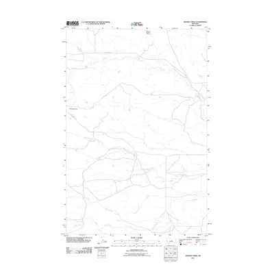
2011 Map of Snoose Creek
USGS Topo · Published 2011About this map
Elk Creek and Snoose Creek define the drainage patterns of this Fergus County landscape, where water management is central to the local geography. The presence of the J Schultz Number 1 Dam in the north indicates the critical role of ranching and irrigation infrastructure in this part of Montana. Transportation through the area relies on historic thoroughfares such as Old Winnett Rd and Yellow Water Rd, which traverse the open terrain near Tennessee Flat. The map documents a network of seasonal and perennial waterways, including Yellow Water Creek, its North Fork, and Bender Creek. This 2011 survey captures the spatial relationship between these named landmarks and the rural road network, providing a clear view of the region's land use and hydrology at the start of the decade.
Find a feature on this map
9 named features on this map. Tap any name to fly to it.
Don’t see what you’re looking for? This feature index may not catch every label — zoom into the map to look around manually.
Map Details
Editions of this 2011 Snoose Creek Map
This is the sole edition of this map. No revisions or reprints were ever made.
Other maps of this area

1954 · Roundup
USGS Topo · 1:250,000

1954 · Lewistown
USGS Topo · 1:250,000

1958 · Roundup
USGS Topo · 1:250,000

1959 · Lewistown
USGS Topo · 1:250,000

1986 · Snoose Creek
USGS Topo · 1:24,000

1986 · Briggs Coulee
USGS Topo · 1:24,000

1986 · Pike Creek Hills West
USGS Topo · 1:24,000

1986 · Flatwillow
USGS Topo · 1:24,000

1986 · Pike Creek Hills East
USGS Topo · 1:24,000

1986 · Milk Springs
USGS Topo · 1:24,000