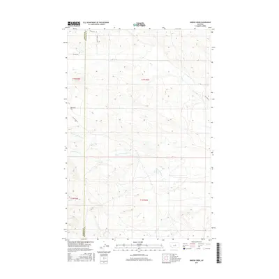
2017 Map of Snoose Creek
USGS Topo · Published 2017About this map
Tennessee Flat anchors the central landscape of this western prairie terrain, where the headwaters and drainage networks of several seasonal creeks define the geography. The map illustrates a remote intersection of land management and natural drainage, with the north-south boundary between Fergus Co and Petroleum Co bisecting the region. Watercourses such as Yellow Water Creek, Elk Creek, and Bender Creek meander through the coulees, illustrating the complex hydrology of the high plains. The transition of the landscape is further marked by Snoose Creek in the southeastern portion. This survey provides a precise look at the sparse transportation network of the late 2010s, including Elk Creek Rd and King Ranch Rd, which follow the natural contours and ridges between the various creek basins.
Find a feature on this map
15 named features on this map. Tap any name to fly to it.
Don’t see what you’re looking for? This feature index may not catch every label — zoom into the map to look around manually.
Map Details
Editions of this 2017 Snoose Creek Map
This is the sole edition of this map. No revisions or reprints were ever made.
Other maps of this area

1954 · Roundup
USGS Topo · 1:250,000

1954 · Lewistown
USGS Topo · 1:250,000

1958 · Roundup
USGS Topo · 1:250,000

1959 · Lewistown
USGS Topo · 1:250,000

1986 · Snoose Creek
USGS Topo · 1:24,000

1986 · Briggs Coulee
USGS Topo · 1:24,000

1986 · Pike Creek Hills West
USGS Topo · 1:24,000

1986 · Flatwillow
USGS Topo · 1:24,000

1986 · Pike Creek Hills East
USGS Topo · 1:24,000

1986 · Milk Springs
USGS Topo · 1:24,000