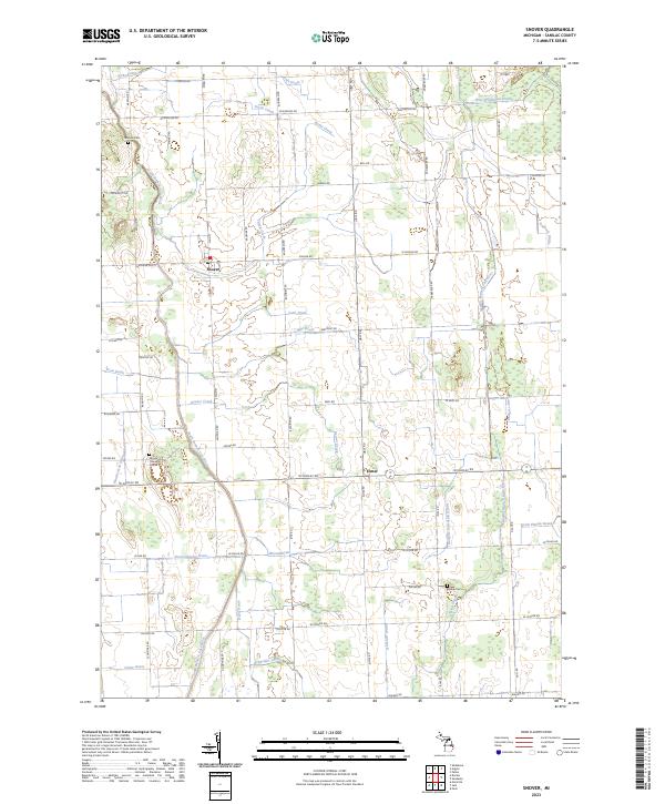
2023 Map of Snover
USGS Topo · Published 2023About this map
Snover and Elmer serve as the primary focal points in this agricultural landscape within Sanilac County. The terrain is defined by a dense network of managed watercourses including Kirby Drain, Brice Wightman Drain, and Babcock Drain, which feed into the larger South Branch Cass River and Middle Branch Cass River. These drainage systems illustrate the extensive effort required to maintain the productivity of the local farmland. Local history and genealogy are anchored by several markers of early settlement, including Johnson Cem in the north and the Moore Township Cem further south. The land is organized by a precise grid of rural roads such as Mushroom Rd and Ubly Rd, while named features like Tank Drain and Beals Frizzle Drain highlight the specific hydrological engineering of this Michigan thumb region.
Find a feature on this map
71 named features on this map. Tap any name to fly to it.
Don’t see what you’re looking for? This feature index may not catch every label — zoom into the map to look around manually.
Map Details
Editions of this 2023 Snover Map
This is the sole edition of this map. No revisions or reprints were ever made.
Other maps of this area

1954 · Flint
USGS Topo · 1:250,000

1958 · Flint
USGS Topo · 1:250,000

1963 · Snover
USGS Topo · 1:24,000

1963 · Sandusky
USGS Topo · 1:24,000

1963 · Peck
USGS Topo · 1:24,000

1963 · Juhl
USGS Topo · 1:24,000

1963 · Marlette
USGS Topo · 1:24,000

1963 · Palms
USGS Topo · 1:24,000

1963 · Shabbona
USGS Topo · 1:24,000
1963 · Decker
USGS Topo · 1:24,000