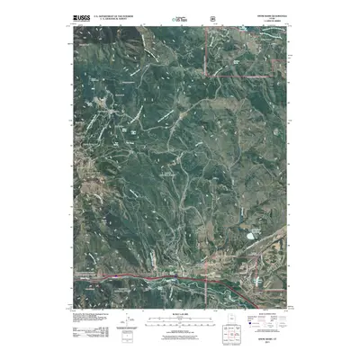
2011 Map of Snow Basin
USGS Topo · Published 2011About this map
Mountain Green and the surrounding Morgan Valley sit at the crossroads of mountain recreation and agricultural heritage in this 2011 record of the Wasatch Range. The landscape is dominated by the steep slopes of Snow Basin Ski Area, featuring iconic peaks and bowls such as De Moisy Peak, The Needles, and Mount Ogden Bowl. These alpine features transition sharply into the drainage systems of the Weber River and Cottonwood Creek, where the valley floor supports infrastructure like the Morgan Municipal Airport and the Mountain Green Cemetery.
Find a feature on this map
53 named features on this map. Tap any name to fly to it.
Don’t see what you’re looking for? This feature index may not catch every label — zoom into the map to look around manually.
Map Details
Editions of this 2011 Snow Basin Map
This is the sole edition of this map. No revisions or reprints were ever made.
Other maps of this area

1954 · Ogden
USGS Topo · 1:250,000

1955 · Ogden
USGS Topo · 1:24,000

1955 · Peterson
USGS Topo · 1:24,000

1955 · Huntsville
USGS Topo · 1:24,000

1955 · North Ogden
USGS Topo · 1:24,000

1955 · Kaysville
USGS Topo · 1:24,000

1955 · Snow Basin
USGS Topo · 1:24,000

1958 · Ogden
USGS Topo · 1:250,000

1960 · Ogden
USGS Topo · 1:250,000
1961 · Morgan
USGS Topo · 1:24,000