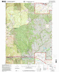
1998 Map of Snow Basin
USGS Topo · Published 2001About this map
Snow Basin and the high ridges of the Cache National Forest dominate this landscape during a period of significant preparation for the 2002 Winter Games. The map identifies the Snowbasin Ski Area as a primary venue, with notable peaks such as Mt Ogden Bowl, Strawberry Peak, and The Needles surrounding the alpine basin. In the lower elevations to the south, the settlement of Mountain Green sits near the Weber River, where modern infrastructure like the County Airport and various utilities support the growing community.
Find a feature on this map
63 named features on this map. Tap any name to fly to it.
Don’t see what you’re looking for? This feature index may not catch every label — zoom into the map to look around manually.
Map Details
Editions of this 1998 Snow Basin Map
This is the sole edition of this map. No revisions or reprints were ever made.
Other maps of this area

1954 · Ogden
USGS Topo · 1:250,000

1955 · Ogden
USGS Topo · 1:24,000

1955 · Peterson
USGS Topo · 1:24,000

1955 · Huntsville
USGS Topo · 1:24,000

1955 · North Ogden
USGS Topo · 1:24,000

1955 · Kaysville
USGS Topo · 1:24,000

1955 · Snow Basin
USGS Topo · 1:24,000

1958 · Ogden
USGS Topo · 1:250,000

1960 · Ogden
USGS Topo · 1:250,000
1961 · Morgan
USGS Topo · 1:24,000