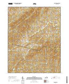
2019 Map of Snow Creek
USGS Topo · Published 2019About this map
Figsboro and the surrounding highlands of the Franklin and Henry county border define this 2019 survey. The landscape is a network of ridges and knobs, including the prominent Turkeycock Mtn and Fork Mtn, which separate the various drainages of the Snow Cr and Reed Cr systems. The settlement pattern is characterized by homesteads and family burial grounds that have persisted across generations, tucked into the gaps and along the secondary routes like Figsboro Rd and Snow Creek Rd.
Find a feature on this map
93 named features on this map. Tap any name to fly to it.
Don’t see what you’re looking for? This feature index may not catch every label — zoom into the map to look around manually.
Map Details
Editions of this 2019 Snow Creek Map
This is the sole edition of this map. No revisions or reprints were ever made.
Other maps of this area

1922 · Callands
USGS Topo · 1:48,000

1924 · Martinsville
USGS Topo · 1:48,000

1924 · Draper
USGS Topo · 1:48,000

1924 · Callands
USGS Topo · 1:62,500

1925 · Rocky Mount
USGS Topo · 1:48,000

1926 · Martinsville
USGS Topo · 1:62,500

1926 · Draper
USGS Topo · 1:62,500

1927 · Rocky Mount
USGS Topo · 1:62,500

1927 · Martinsville
USGS Topo · 1:62,500

1944 · Martinsville
USGS Topo · 1:62,500