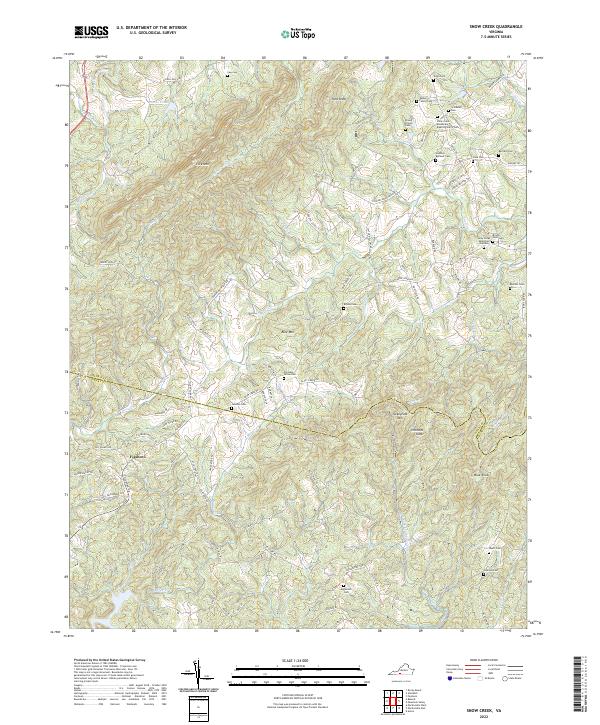
2022 Map of Snow Creek
USGS Topo · Published 2022About this map
Figsboro sits at the western edge of a landscape defined by the rugged interface of the Piedmont and Blue Ridge foothills, where the boundary between Franklin and Henry counties cuts across the drainage basins of the Smith and Dan Rivers. The map reveals a dense concentration of family burial grounds and community landmarks that speak to generations of rural settlement, including the Snow Creek Missionary Baptist Church Cem and the Eames Family Cem.
Find a feature on this map
97 named features on this map. Tap any name to fly to it.
Don’t see what you’re looking for? This feature index may not catch every label — zoom into the map to look around manually.
Map Details
Editions of this 2022 Snow Creek Map
This is the sole edition of this map. No revisions or reprints were ever made.
Other maps of this area

1922 · Callands
USGS Topo · 1:48,000

1924 · Martinsville
USGS Topo · 1:48,000

1924 · Draper
USGS Topo · 1:48,000

1924 · Callands
USGS Topo · 1:62,500

1925 · Rocky Mount
USGS Topo · 1:48,000

1926 · Martinsville
USGS Topo · 1:62,500

1926 · Draper
USGS Topo · 1:62,500

1927 · Rocky Mount
USGS Topo · 1:62,500

1927 · Martinsville
USGS Topo · 1:62,500

1944 · Martinsville
USGS Topo · 1:62,500