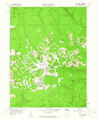
1960 Map of Snow Shoe
USGS Topo · Published 1963About this map
The borough of Snow Shoe and the nearby unincorporated community of Clarence serve as the primary anchors for this 1960 field-checked survey of central Pennsylvania. The landscape is defined by the heavy footprint of industrial activity, most notably the extensive Strip Mine operations that weave through the highlands near Old Side and Pancake. The presence of the New York Central railroad underscores the region's reliance on mineral extraction and transport during this era.
Find a feature on this map
58 named features on this map. Tap any name to fly to it.
Don’t see what you’re looking for? This feature index may not catch every label — zoom into the map to look around manually.
Map Details
Editions of this 1960 Snow Shoe Map
4 editions found
Other maps of this area

1908 · Bellefonte
USGS Topo · 1:62,500

1909 · Bellefonte
USGS Topo · 1:62,500

1922 · Philipsburg
USGS Topo · 1:62,500

1928 · Snow Shoe
USGS Topo · 1:48,000

1929 · Karthaus
USGS Topo · 1:62,500

1931 · Show Shoe
USGS Topo · 1:62,500

1932 · Karthaus
USGS Topo · 1:62,500

1939 · Philipsburg
USGS Topo · 1:62,500

1943 · Lewistown
USGS Topo · 1:125,000

1945 · Philipsburg
USGS Topo · 1:62,500