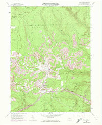
1960 Map of Snow Shoe
USGS Topo · Published 1972About this map
Snow Shoe and Clarence serve as the primary hubs in this survey of northern Centre County, appearing during a period of significant landscape transformation. The map documents an extensive history of extractive industry, specifically visible through numerous Strip Mine excavations on Old Side and Poorman Side. These industrial sites contrast with the vast preserved acreage of the Sproul State Forest and State Game Lands No 100 to the north and west. Transportation is a central theme, featuring the Penn Central rail line winding through the valley along Cherry Run and the presence of the modern Interchange 22. Local genealogy and social history are anchored by landmarks like St Michaels Cem, St Marys Cem, and several hunting or recreational outposts such as Hartline Camp and Beauty Camp, reflecting the dual character of the region as both an industrial zone and a woodland retreat.
Find a feature on this map
59 named features on this map. Tap any name to fly to it.
Don’t see what you’re looking for? This feature index may not catch every label — zoom into the map to look around manually.
Map Details
Editions of this 1960 Snow Shoe Map
4 editions found
Other maps of this area

1908 · Bellefonte
USGS Topo · 1:62,500

1909 · Bellefonte
USGS Topo · 1:62,500

1922 · Philipsburg
USGS Topo · 1:62,500

1928 · Snow Shoe
USGS Topo · 1:48,000

1929 · Karthaus
USGS Topo · 1:62,500

1931 · Show Shoe
USGS Topo · 1:62,500

1932 · Karthaus
USGS Topo · 1:62,500

1939 · Philipsburg
USGS Topo · 1:62,500

1943 · Lewistown
USGS Topo · 1:125,000

1945 · Philipsburg
USGS Topo · 1:62,500