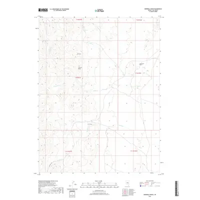
2018 Map of Snowball Ranch
USGS Topo · Published 2018About this map
Snowball Ranch serves as a central landmark in this remote section of Nye County, where the desert landscape is defined by its vital water sources. The map reveals a complex network of springs, such as Wild Indian Spring, Pine Spring, and Willow Spring, which likely supported early ranching and migration through this arid territory. These springs feed intermittent drainages like Indian Cr and Snowball Cr, illustrating the critical role of hydrology in Great Basin settlement patterns.
Find a feature on this map
24 named features on this map. Tap any name to fly to it.
Don’t see what you’re looking for? This feature index may not catch every label — zoom into the map to look around manually.
Map Details
Editions of this 2018 Snowball Ranch Map
This is the sole edition of this map. No revisions or reprints were ever made.
Other maps of this area

1926 · Roberts Mountains
USGS Topo · 1:250,000

1929 · Roberts Mountains
USGS Topo · 1:250,000

1955 · Millett
USGS Topo · 1:250,000

1956 · Cockalorum Wash
USGS Topo · 1:62,500

1956 · Horse Heaven Mtn
USGS Topo · 1:62,500

1956 · Tonopah
USGS Topo · 1:250,000

1959 · Tonopah
USGS Topo · 1:250,000

1959 · Millett
USGS Topo · 1:250,000

1962 · Tonopah
USGS Topo · 1:250,000

1968 · Pritchards Station
USGS Topo · 1:62,500