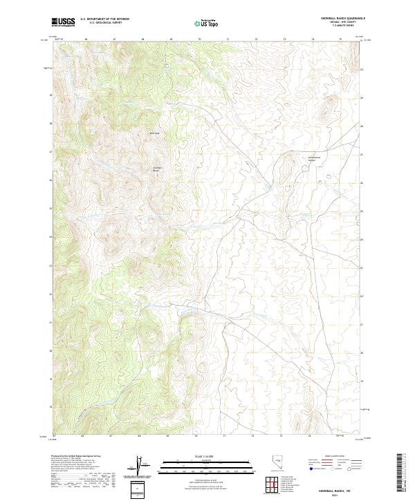
2021 Map of Snowball Ranch
USGS Topo · Published 2021About this map
Bills Peak and the southern reaches of the Antelope Range define this high-elevation landscape in northeastern Nye County. The terrain is characterized by a dense network of seasonal water sources and drainages, where named landmarks like Cottonwood Canyon provide natural corridors through the ridges. Numerous isolated water points, including Deer Spring, Wild Indian Spring, and Rock Spring, suggest a landscape historically reliant on these specific locations for livestock or travel. In the southern portion of the survey, the drainages of Snowball Cr and Moonshine Creek flow through the township boundaries of T13.5N and T14N. This area, largely defined by the intersection of the Willow Cr and Indian Cr systems, remains a remote section of Nevada's basin and range province, with few man-made structures shown beyond the established township and range grid lines.
Find a feature on this map
23 named features on this map. Tap any name to fly to it.
Don’t see what you’re looking for? This feature index may not catch every label — zoom into the map to look around manually.
Map Details
Editions of this 2021 Snowball Ranch Map
This is the sole edition of this map. No revisions or reprints were ever made.
Other maps of this area

1926 · Roberts Mountains
USGS Topo · 1:250,000

1929 · Roberts Mountains
USGS Topo · 1:250,000

1955 · Millett
USGS Topo · 1:250,000

1956 · Cockalorum Wash
USGS Topo · 1:62,500

1956 · Horse Heaven Mtn
USGS Topo · 1:62,500

1956 · Tonopah
USGS Topo · 1:250,000

1959 · Tonopah
USGS Topo · 1:250,000

1959 · Millett
USGS Topo · 1:250,000

1962 · Tonopah
USGS Topo · 1:250,000

1968 · Pritchards Station
USGS Topo · 1:62,500