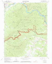
1966 Map of Snowden
USGS Topo · Published 1979About this map
The James River carves through the Blue Ridge mountains on this mid-century survey, creating a dramatic corridor for transportation and recreation. The Chesapeake and Ohio railroad follows the river's northern bank through Natural Bridge Station and Greenlee, while the Blue Ridge Parkway winds across the high ridges to the south, marked by numerous overlooks like the Thunder Ridge Overlook. This landscape is defined by the intersection of the George Washington National Forest and the Jefferson National Forest, with the Appalachian Trail traversing the crests. Local life is anchored in several country churches, including Sharon Ch and Hunting Creek Ch, alongside small settlements like Snowden. The presence of the Balcony Falls Dam and various trail shelters like the Johns Hollow Shelter indicates a region balancing early industrial river use with the growth of mountain tourism.
Find a feature on this map
60 named features on this map. Tap any name to fly to it.
Don’t see what you’re looking for? This feature index may not catch every label — zoom into the map to look around manually.
Map Details
Editions of this 1966 Snowden Map
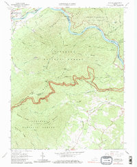
2 editions found
Other maps of this area

1890 · Roanoke
USGS Topo · 1:125,000

1891 · Roanoke
USGS Topo · 1:125,000

1892 · Lynchburg
USGS Topo · 1:125,000

1894 · Natural Bridge
USGS Topo · 1:125,000

1894 · Lexington
USGS Topo · 1:125,000

1894 · Natural Bridge
USGS Topo · 1:62,500

1907 · Natural Bridge Special
USGS Topo · 1:62,500

1935 · Buena Vista
USGS Topo · 1:48,000

1939 · Buena Vista
USGS Topo · 1:62,500

1940 · Buena Vista
USGS Topo · 1:62,500