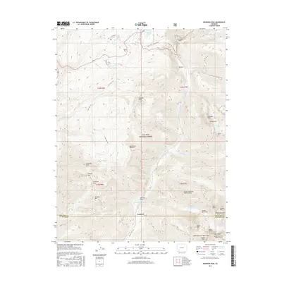
2016 Map of Snowdon Peak
USGS Topo · Published 2016About this map
Needleton serves as a remote anchor point along the Animas River in this high-altitude survey of the San Juan National Forest. The landscape is dominated by the steep verticality of the West Needle Mountains and the Grenadier Range, where sharp peaks like Snowdon Peak, Mt Garfield, and Pigeon Peak define the horizon. This region is a vital corridor for high-country travel, featuring the crossing at Molas Pass and the combined path of the Molas Trail / Colorado Trail. At the southern edge of the map, the Needleton Water Tank and Needleton Creek Trail mark the convergence of valley infrastructure and alpine wilderness. Water features are concentrated in the north and west, with Andrews Lake, Molas Lake, and Crater Lake providing notable landmarks for backcountry navigation between the granite summits of the Needle Mountains.
Find a feature on this map
50 named features on this map. Tap any name to fly to it.
Don’t see what you’re looking for? This feature index may not catch every label — zoom into the map to look around manually.
Map Details
Editions of this 2016 Snowdon Peak Map
This is the sole edition of this map. No revisions or reprints were ever made.
Other maps of this area

1897 · Telluride
USGS Topo · 1:62,500

1897 · Silverton
USGS Topo · 1:62,500

1898 · Engineer Mountain
USGS Topo · 1:62,500

1900 · Engineer Mountain
USGS Topo · 1:62,500

1900 · Needle Mountains
USGS Topo · 1:62,500

1901 · Silverton
USGS Topo · 1:62,500

1902 · Needle Mountains
USGS Topo · 1:62,500

1902 · Silverton
USGS Topo · 1:62,500

1904 · Telluride
USGS Topo · 1:62,500

1908 · Engineer Mountain
USGS Topo · 1:62,500