
1956 Map of Snyder
USGS Topo · Published 1959About this map
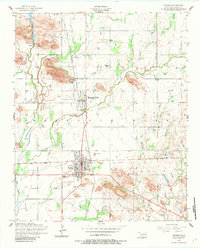
The railroad junction at Snyder serves as the focal point of this Kiowa County survey, where the tracks of the St Louis San Francisco railroad intersect. The landscape is defined by the granite outcrops of the Mountain Park area and the various branches of the local drainage system. To the north, Snyder Lake provides a primary water source, supported by a dedicated Pumping station and Filtration bed. The settlement of Mountain Park sits nestled between the rocky elevations, showing a distinct grid of streets and local infrastructure including a Swimming pool. This mid-century view captures the essential utility of the region, from the Power substation and Gas tanks in the southern portion of the map to the Snyder Cemetery and Mountain Park Cemetery that serve these rural communities.
Find a feature on this map
17 named features on this map. Tap any name to fly to it.
Don’t see what you’re looking for? This feature index may not catch every label — zoom into the map to look around manually.
Map Details
Editions of this 1956 Snyder Map
2 editions found
Other maps of this area

1949 · Cooperton
USGS Topo · 1:62,500

1950 · Snyder
USGS Topo · 1:62,500

1955 · Lawton
USGS Topo · 1:250,000

1956 · Glen Mountains
USGS Topo · 1:24,000

1956 · Cooperton
USGS Topo · 1:24,000

1956 · Odetta
USGS Topo · 1:24,000

1956 · Manitou
USGS Topo · 1:24,000

1956 · Indiahoma
USGS Topo · 1:24,000

1956 · Snyder
USGS Topo · 1:62,500

1956 · Cooperton
USGS Topo · 1:62,500