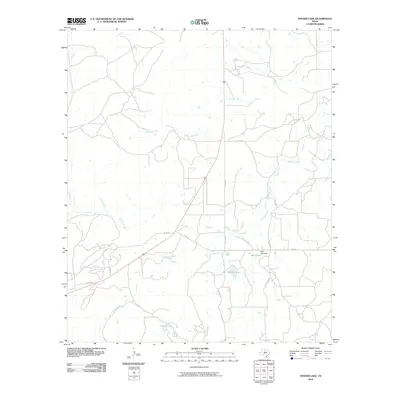
2010 Map of Snyder Lake
USGS Topo · Published 2010About this map
Snyder Lake and the neighboring Diller Lake define this pocket of north central Texas, where the landscape is carved by a network of seasonal and permanent waterways. The drainage patterns of Hubbard Creek, Reynolds Creek, and Jenkins Creek converge in this area, illustrating the hydraulic geography essential to rural land use. The presence of the Diller Lake Dam highlights local water management efforts in an environment characterized by creek-fed reservoirs. While primarily an open landscape of ranch and agricultural lands, the area is connected by a sparse grid of roads such as FM 576 and FM 578, along with numerous private and county routes including PVT RD 1620 and Co RD 191, which provide access to interior holdings.
Find a feature on this map
17 named features on this map. Tap any name to fly to it.
Don’t see what you’re looking for? This feature index may not catch every label — zoom into the map to look around manually.
Map Details
Editions of this 2010 Snyder Lake Map
This is the sole edition of this map. No revisions or reprints were ever made.
Other maps of this area

1892 · Albany
USGS Topo · 1:125,000

1893 · Albany
USGS Topo · 1:125,000

1931 · Baird
USGS Topo · 1:125,000

1932 · Baird
USGS Topo · 1:125,000

1954 · Abilene
USGS Topo · 1:250,000

1958 · Abilene
USGS Topo · 1:250,000

1965 · Acampo
USGS Topo · 1:24,000

1965 · Albany
USGS Topo · 1:24,000

1965 · McCatherine Mountain
USGS Topo · 1:24,000
1965 · Snyder Lake
USGS Topo · 1:24,000