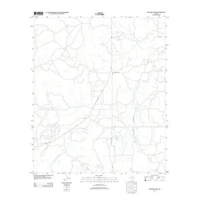
2012 Map of Snyder Lake
USGS Topo · Published 2012About this map
Snyder Lake and Diller Lake anchor the central portion of this rural Shackelford County landscape, where the terrain is defined by a dendritic network of seasonal drainages. These waters, including Hubbard Cr and Reynolds Cr, create a complex natural irrigation system for the surrounding ranchlands. The map reveals a highly structured private and county road system, characterized by routes such as FM-576, Co Rd-191, and Co Rd-327. This infrastructure facilitates movement between localized ranching operations and water sources in a region where water management is critical to land use. The presence of several private thoroughfares, like Private Road 1620, suggests a landscape dominated by large, partitioned landholdings rather than dense municipal development.
Find a feature on this map
15 named features on this map. Tap any name to fly to it.
Don’t see what you’re looking for? This feature index may not catch every label — zoom into the map to look around manually.
Map Details
Editions of this 2012 Snyder Lake Map
This is the sole edition of this map. No revisions or reprints were ever made.
Other maps of this area

1892 · Albany
USGS Topo · 1:125,000

1893 · Albany
USGS Topo · 1:125,000

1931 · Baird
USGS Topo · 1:125,000

1932 · Baird
USGS Topo · 1:125,000

1954 · Abilene
USGS Topo · 1:250,000

1958 · Abilene
USGS Topo · 1:250,000

1965 · Acampo
USGS Topo · 1:24,000

1965 · Albany
USGS Topo · 1:24,000

1965 · McCatherine Mountain
USGS Topo · 1:24,000
1965 · Snyder Lake
USGS Topo · 1:24,000