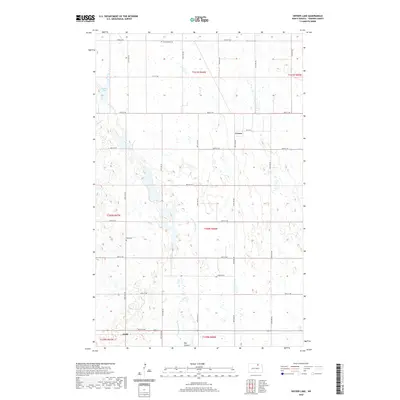
2020 Map of Snyder Lake
USGS Topo · Published 2020About this map
Mauvais Coulee meanders through this portion of Towner County, carving a distinct path through the prairie landscape as it heads toward Big Coulee. The rural character of the area is anchored by the small settlements of Crocus and Arndt, which serve as markers for a community defined by its township-and-range agricultural grid. Genealogists and local historians will find significant value in the location of the Brumbaugh Cem and Zion Cem, which remain as permanent fixtures amidst the shifting agricultural fields. Water features like Brumba Pool punctuate the terrain, reflecting the wetland dynamics typical of this region of North Dakota. The transportation network is dominated by a systematic grid of county roads, including Krueger Dr and 84th St NE, facilitating movement between the isolated farmsteads and larger regional centers via Route 281.
Find a feature on this map
25 named features on this map. Tap any name to fly to it.
Don’t see what you’re looking for? This feature index may not catch every label — zoom into the map to look around manually.
Map Details
Editions of this 2020 Snyder Lake Map
This is the sole edition of this map. No revisions or reprints were ever made.
Other maps of this area

1953 · Devils Lake
USGS Topo · 1:250,000

1956 · Devils Lake
USGS Topo · 1:250,000

1962 · Egeland SE
USGS Topo · 1:24,000

1962 · Egeland SW
USGS Topo · 1:24,000

1962 · Egeland
USGS Topo · 1:24,000

1962 · Snyder Lake
USGS Topo · 1:24,000

1970 · Hansboro SE
USGS Topo · 1:24,000

1970 · Rock Lake
USGS Topo · 1:24,000

1970 · Rock Lake SE
USGS Topo · 1:24,000

1971 · Considine
USGS Topo · 1:24,000