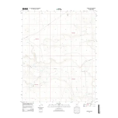
2013 Map of Snyder Lake
USGS Topo · Published 2013About this map
Snyder Lake serves as a central landmark in this high-plains landscape of Union County, where the terrain is defined by the winding drainages of Carrizo Cr and Perico Cr. The map reflects a rural ranching and transport environment, with the small named locations of Chambers and Wiley situated along the county road network. The presence of Cinder Mtn in the north indicates the volcanic geology characteristic of this region of Northeast New Mexico. Movement through the area is facilitated by a system of rural routes, including CO Highway A-007 and CO Highway A-016, which connect the isolated homesteads and grazing lands. Researchers can trace the intricate relationship between the intermittent waterways like Cedar Cr and the historical land divisions of T26N and T25N.
Find a feature on this map
17 named features on this map. Tap any name to fly to it.
Don’t see what you’re looking for? This feature index may not catch every label — zoom into the map to look around manually.
Map Details
Editions of this 2013 Snyder Lake Map
This is the sole edition of this map. No revisions or reprints were ever made.
Other maps of this area

1954 · Dalhart
USGS Topo · 1:250,000

1958 · Dalhart
USGS Topo · 1:250,000

1962 · Dalhart
USGS Topo · 1:250,000

1966 · Black Canyon
USGS Topo · 1:24,000

1966 · Tate School
USGS Topo · 1:24,000

1972 · Mount Dora
USGS Topo · 1:24,000

1973 · Grenville SW
USGS Topo · 1:24,000

1973 · Snyder Lake
USGS Topo · 1:24,000

1973 · Tripod Mountain
USGS Topo · 1:24,000
1973 · Goat Canyon
USGS Topo · 1:24,000