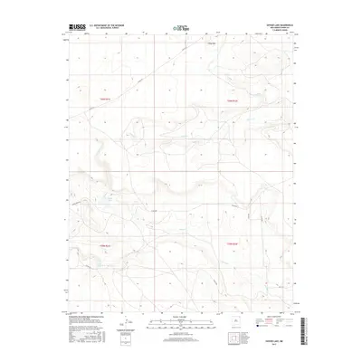
2017 Map of Snyder Lake
USGS Topo · Published 2017About this map
Cinder Mtn rises above the high plains of Union County, anchoring a landscape defined by the drainage basins of Perico Cr and Carrizo Cr. This 2017 survey shows a remote ranching territory where water access is concentrated at Snyder Lake and along the winding courses of Cedar Cr. The map reveals a sparse but vital network of county infrastructure, where long stretches of unpaved transit like Atchely Rd and Davis Rd connect distant homesteads. These roads follow the natural contours of the mesas and draws, illustrating the enduring influence of topography on land use in this corner of New Mexico. For researchers, the preservation of family names in the road network, such as Wiley Rd, provides a direct link to the local ranching legacy and historical property boundaries established under the Public Land Survey System.
Find a feature on this map
17 named features on this map. Tap any name to fly to it.
Don’t see what you’re looking for? This feature index may not catch every label — zoom into the map to look around manually.
Map Details
Editions of this 2017 Snyder Lake Map
This is the sole edition of this map. No revisions or reprints were ever made.
Other maps of this area

1954 · Dalhart
USGS Topo · 1:250,000

1958 · Dalhart
USGS Topo · 1:250,000

1962 · Dalhart
USGS Topo · 1:250,000

1966 · Black Canyon
USGS Topo · 1:24,000

1966 · Tate School
USGS Topo · 1:24,000

1972 · Mount Dora
USGS Topo · 1:24,000

1973 · Grenville SW
USGS Topo · 1:24,000

1973 · Snyder Lake
USGS Topo · 1:24,000

1973 · Tripod Mountain
USGS Topo · 1:24,000
1973 · Goat Canyon
USGS Topo · 1:24,000