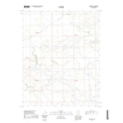
2023 Map of Snyder Lake
USGS Topo · Published 2023About this map
Cinder Mountain rises above a landscape defined by ephemeral waterways in this Union County survey. The area is characterized by a network of drainage systems, including the eastward-flowing Perico Creek, Carrizo Creek, and Cedar Creek, which carve winding paths through the high plains terrain. This specific geography highlights the importance of water management and natural drainage in the ranching lands of northeastern New Mexico.
Find a feature on this map
16 named features on this map. Tap any name to fly to it.
Don’t see what you’re looking for? This feature index may not catch every label — zoom into the map to look around manually.
Map Details
Editions of this 2023 Snyder Lake Map
This is the sole edition of this map. No revisions or reprints were ever made.
Other maps of this area

1954 · Dalhart
USGS Topo · 1:250,000

1958 · Dalhart
USGS Topo · 1:250,000

1962 · Dalhart
USGS Topo · 1:250,000

1966 · Black Canyon
USGS Topo · 1:24,000

1966 · Tate School
USGS Topo · 1:24,000

1972 · Mount Dora
USGS Topo · 1:24,000

1973 · Grenville SW
USGS Topo · 1:24,000

1973 · Snyder Lake
USGS Topo · 1:24,000

1973 · Tripod Mountain
USGS Topo · 1:24,000
1973 · Goat Canyon
USGS Topo · 1:24,000