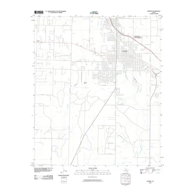
2010 Map of Snyder
USGS Topo · Published 2010About this map
Snyder serves as the regional hub in this 2010 survey of Scurry County, where the convergence of industrial progress and rural Texas landscapes is clearly marked. The town is defined by a dense street grid and significant landmarks such as Snyder Cemetery and the regional aviation hub at Winston Field. The surrounding terrain is shaped by the winding paths of Deep Creek, South Fork Deep Creek, and Canyon Creek, which carve through the plains. Outlying areas like Union are connected by a web of rural roads, including Lubbock Hwy and Hart Ranch Rd, indicating the continued importance of ranching and infrastructure. This edition documents the expansion of modern residential and industrial developments, like High Mesa Dr, juxtaposed with established ranching routes and the foundational watercourses that have historically supported this West Texas community.
Find a feature on this map
44 named features on this map. Tap any name to fly to it.
Don’t see what you’re looking for? This feature index may not catch every label — zoom into the map to look around manually.
Map Details
Editions of this 2010 Snyder Map
This is the sole edition of this map. No revisions or reprints were ever made.
Other maps of this area

1951 · Ira
USGS Topo · 1:24,000

1951 · Dunn
USGS Topo · 1:24,000

1952 · Snyder
USGS Topo · 1:24,000

1952 · China Grove
USGS Topo · 1:24,000

1952 · Ira NE
USGS Topo · 1:24,000

1952 · Hermleigh
USGS Topo · 1:24,000

1954 · Lloyd Mountain
USGS Topo · 1:24,000

1954 · Dermott
USGS Topo · 1:24,000

1954 · Brand
USGS Topo · 1:24,000

1954 · Big Spring
USGS Topo · 1:250,000