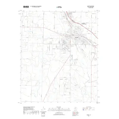
2019 Map of Snyder
USGS Topo · Published 2019About this map
The West Texas city of Snyder serves as the focal point of this 2019 survey, showcasing the urban expansion of the Scurry County seat against the backdrop of the Llano Estacado. The map details the transition from the city's dense street grid to the surrounding rural landscape, marked by significant infrastructure such as Winston Field to the southwest and the Snyder Cem on the northeastern edge of town. Waterways like Deep Cr and its S Fork Deep Cr cut through the terrain, leading toward the distinctively named Hell Roaring Hollow in the southeast. This contemporary record captures the modern footprint of settlements like Union and the complex web of farm-to-market roads and county routes that support the region's agricultural and energy-based economy, providing a clear view of the area's current development and natural drainage patterns.
Find a feature on this map
120 named features on this map. Tap any name to fly to it.
Don’t see what you’re looking for? This feature index may not catch every label — zoom into the map to look around manually.
Map Details
Editions of this 2019 Snyder Map
This is the sole edition of this map. No revisions or reprints were ever made.
Other maps of this area

1951 · Ira
USGS Topo · 1:24,000

1951 · Dunn
USGS Topo · 1:24,000

1952 · Snyder
USGS Topo · 1:24,000

1952 · China Grove
USGS Topo · 1:24,000

1952 · Ira NE
USGS Topo · 1:24,000

1952 · Hermleigh
USGS Topo · 1:24,000

1954 · Lloyd Mountain
USGS Topo · 1:24,000

1954 · Dermott
USGS Topo · 1:24,000

1954 · Brand
USGS Topo · 1:24,000

1954 · Big Spring
USGS Topo · 1:250,000