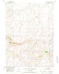
1951 Map of Soap Holes
USGS Topo · Published 1966About this map
Green Mountains dominate the southern portion of this Wyoming landscape, rising toward the peaks of Crooks Mountain in the southeast. This 1951 field check captures a high-desert environment defined by complex hydrology and early industrial exploration. The presence of an Oil Well (Aband) near the eastern boundary hints at the post-war energy prospecting that touched even the most secluded corners of Fremont County. To the north, the terrain flattens into the distinctive Soap Holes area, where drainage from Happy Springs and the slow-moving Ice Slough create a unique network of seasonal water features. This transition from high ridges to low alkali flats and creek bottoms like Haypress Creek illustrates the topographical variety of the Missouri River Basin development program during the mid-twentieth century.
Find a feature on this map
10 named features on this map. Tap any name to fly to it.
Don’t see what you’re looking for? This feature index may not catch every label — zoom into the map to look around manually.
Map Details
Editions of this 1951 Soap Holes Map
3 editions found
Other maps of this area

1951 · Soap Holes
USGS Topo · 1:24,000

1951 · Graham Ranch
USGS Topo · 1:24,000

1951 · Crooks Mountain
USGS Topo · 1:24,000

1951 · Myers Ranch
USGS Topo · 1:24,000

1953 · Sweetwater Station
USGS Topo · 1:24,000

1953 · Happy Spring
USGS Topo · 1:24,000

1955 · Lander
USGS Topo · 1:250,000

1955 · Casper
USGS Topo · 1:250,000

1958 · Casper
USGS Topo · 1:250,000

1958 · Lander
USGS Topo · 1:250,000