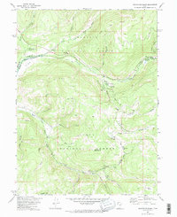
1972 Map of Soapstone Basin
USGS Topo · Published 1974About this map
The Provo River and its numerous tributaries carve through the high mountain terrain of the Wasatch National Forest and Uinta National Forest in this early 1970s survey. The landscape is defined by the high elevations of Soapstone Mountain and the broad expanse of the Soapstone Basin, with the Summit and Wasatch county line dividing the northern and southern halves of the sheet. Human activity is largely centered on seasonal recreation and resource management, evidenced by facilities like the Soapstone Guard Sta and a series of forest service campgrounds including Pine Valley Group Campground and Shady Dell Campground.
Find a feature on this map
40 named features on this map. Tap any name to fly to it.
Don’t see what you’re looking for? This feature index may not catch every label — zoom into the map to look around manually.
Map Details
Editions of this 1972 Soapstone Basin Map
2 editions found
Other maps of this area

1885 · Salt Lake
USGS Topo · 1:250,000

1885 · Uinta
USGS Topo · 1:250,000

1900 · Coalville
USGS Topo · 1:125,000

1901 · Hayden Peak
USGS Topo · 1:125,000

1903 · Hayden Peak
USGS Topo · 1:125,000

1903 · Coalville
USGS Topo · 1:125,000

1907 · Strawberry Valley
USGS Topo · 1:125,000

1909 · Strawberry Valley
USGS Topo · 1:125,000

1954 · Salt Lake City
USGS Topo · 1:250,000

1958 · Salt Lake City
USGS Topo · 1:250,000