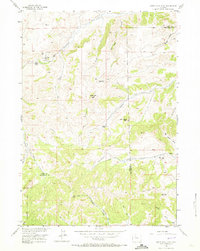
1956 Map of Soapy Dale Peak
USGS Topo · Published 1973About this map
Soapy Dale Peak rises as the central landmark in this high-altitude landscape where Park and Hot Springs counties meet. The 1956 survey reveals a terrain defined by cattle ranching and resource exploration, marked by the presence of Dollar Ranch, Buckles Ranch, and The Dipper (Cow Camp). A network of primitive routes, including the Elk Creek Trail and various jeep trails, provides access to the drainages of Gooseberry Creek and Enos Creek.
Find a feature on this map
34 named features on this map. Tap any name to fly to it.
Don’t see what you’re looking for? This feature index may not catch every label — zoom into the map to look around manually.
Map Details
Editions of this 1956 Soapy Dale Peak Map
2 editions found
Other maps of this area

1904 · Kirwin
USGS Topo · 1:125,000

1906 · Kirwin
USGS Topo · 1:125,000

1911 · Meeteetse
USGS Topo · 1:62,500

1913 · Meeteetse
USGS Topo · 1:62,500

1955 · Cody
USGS Topo · 1:250,000

1955 · Thermopolis
USGS Topo · 1:250,000

1956 · Milk Creek
USGS Topo · 1:24,000

1956 · Twentyone Creek
USGS Topo · 1:24,000

1956 · Soapy Dale Peak
USGS Topo · 1:24,000

1956 · Adam Weiss Peak
USGS Topo · 1:24,000