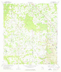
1975 Map of Socrum
USGS Topo · Published 1976About this map
The low-lying wetlands of north-central Florida are meticulously documented here, where the borders of Pasco, Hillsborough, and Polk counties converge. The drainage of Itchepackesassa Creek and Blackwater Creek into the Hillsborough River dominates the landscape, creating a mosaic of swamps and hammocks. Small communities such as Socrum and Kathleen are visible in the southeast, while the settlement of Millard sits further north along the Seaboard Coast Line railroad. Local landmarks like the Bethel Ch and the Fish Hatchery provide glimpses into the rural social and economic fabric of the mid-1970s. The presence of the Lookout Tower and various gaging stations reflects the active management of this water-rich environment, while roads like the Old Dade City Road and Rock Ridge Road maintain the region's historic connectivity.
Find a feature on this map
28 named features on this map. Tap any name to fly to it.
Don’t see what you’re looking for? This feature index may not catch every label — zoom into the map to look around manually.
Map Details
Editions of this 1975 Socrum Map
Other maps of this area

1944 · Plant City
USGS Topo · 1:31,680

1944 · Providence
USGS Topo · 1:31,680

1944 · Lakeland
USGS Topo · 1:31,680

1944 · Antioch
USGS Topo · 1:31,680

1944 · Socrum
USGS Topo · 1:31,680

1947 · Zephyrhills
USGS Topo · 1:24,000

1955 · Plant City
USGS Topo · 1:250,000

1955 · Orlando
USGS Topo · 1:250,000

1957 · Orlando
USGS Topo · 1:250,000

1958 · Orlando
USGS Topo · 1:250,000