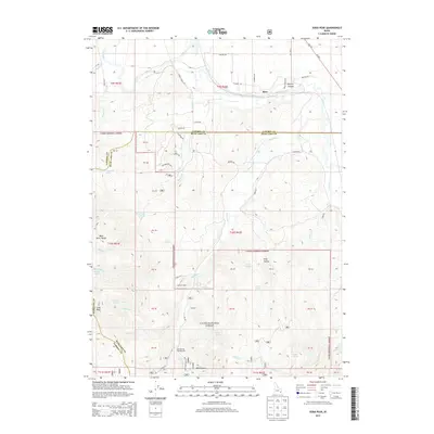
2013 Map of Soda Peak
USGS Topo · Published 2013About this map
Bear River winds through the northern portion of this landscape, just before the terrain rises sharply into the Bear River Range and towards the prominent Soda Peak. This modern survey of the borderlands between Caribou and Bear Lake counties highlights a network of forest roads and trails that follow the natural drainages of Eightmile Cr and Bailey Cr. Evidence of seasonal recreation and land management is clear, with sites such as Cold Spring Campground and Camp Ho-Nok situated among the high-elevation springs.
Find a feature on this map
72 named features on this map. Tap any name to fly to it.
Don’t see what you’re looking for? This feature index may not catch every label — zoom into the map to look around manually.
Map Details
Editions of this 2013 Soda Peak Map
This is the sole edition of this map. No revisions or reprints were ever made.
Other maps of this area

1909 · Montpelier
USGS Topo · 1:125,000

1911 · Montpelier
USGS Topo · 1:125,000

1911 · Slug Creek
USGS Topo · 1:62,500

1915 · Preston
USGS Topo · 1:96,000

1918 · Preston
USGS Topo · 1:125,000

1948 · Soda Springs
USGS Topo · 1:62,500

1949 · Soda Springs
USGS Topo · 1:62,500

1949 · Johnson Creek
USGS Topo · 1:24,000
1951 · Johnson Creek
USGS Topo · 1:24,000

1955 · Preston
USGS Topo · 1:250,000