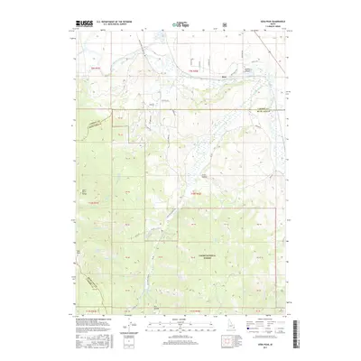
2017 Map of Soda Peak
USGS Topo · Published 2017About this map
The Bear River winds through the northern reaches of this landscape, carving a valley between the Bear River Range and the high peaks of the Cache National Forest. In the late 20th century, this rugged portion of Southeast Idaho remained defined by its water sources and high-elevation terrain, anchored by the settlement of Rose and the high point at Soda Peak. The map reveals a complex network of springs and canyons, including Sulphur Canyon and Trail Hollow, which have long dictated the movement of livestock and people through the region.
Find a feature on this map
68 named features on this map. Tap any name to fly to it.
Don’t see what you’re looking for? This feature index may not catch every label — zoom into the map to look around manually.
Map Details
Editions of this 2017 Soda Peak Map
This is the sole edition of this map. No revisions or reprints were ever made.
Other maps of this area

1909 · Montpelier
USGS Topo · 1:125,000

1911 · Montpelier
USGS Topo · 1:125,000

1911 · Slug Creek
USGS Topo · 1:62,500

1915 · Preston
USGS Topo · 1:96,000

1918 · Preston
USGS Topo · 1:125,000

1948 · Soda Springs
USGS Topo · 1:62,500

1949 · Soda Springs
USGS Topo · 1:62,500

1949 · Johnson Creek
USGS Topo · 1:24,000
1951 · Johnson Creek
USGS Topo · 1:24,000

1955 · Preston
USGS Topo · 1:250,000