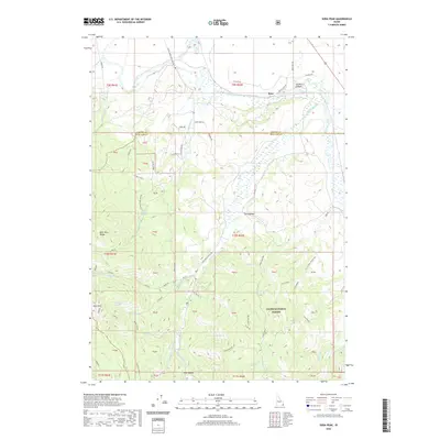
2020 Map of Soda Peak
USGS Topo · Published 2020About this map
Soda Peak and the high ridges of the Bear River Range dominate this landscape in eastern Idaho, where the Bear River carves a path through the northern reaches of the quadrangle. The map documents a rugged montane environment characterized by a complex network of canyons and springs, including Bailey Creek Springs, Willow Flat Spring, and Double Spring. Human impact is visible through historical transport routes like Old Oregon Rd and the Slate Trail, which navigate the steep elevations between the Cache National Forest and the lower valleys near Rose. The terrain is marked by seasonal drainages such as Eightmile Cr and Wilson Cr, flowing toward the river from the prominent Bailey Ridge. This survey provides a clear view of land divisions and resource management boundaries, from the small settlement at Mill Hollow to the expansive protected forest lands.
Find a feature on this map
74 named features on this map. Tap any name to fly to it.
Don’t see what you’re looking for? This feature index may not catch every label — zoom into the map to look around manually.
Map Details
Editions of this 2020 Soda Peak Map
This is the sole edition of this map. No revisions or reprints were ever made.
Other maps of this area

1909 · Montpelier
USGS Topo · 1:125,000

1911 · Montpelier
USGS Topo · 1:125,000

1911 · Slug Creek
USGS Topo · 1:62,500

1915 · Preston
USGS Topo · 1:96,000

1918 · Preston
USGS Topo · 1:125,000

1948 · Soda Springs
USGS Topo · 1:62,500

1949 · Soda Springs
USGS Topo · 1:62,500

1949 · Johnson Creek
USGS Topo · 1:24,000
1951 · Johnson Creek
USGS Topo · 1:24,000

1955 · Preston
USGS Topo · 1:250,000